
– Lat/Long: 32.52° S 19.17° E
 Sneeuberg
Weather Forecast, South AfricaIssued: 7 pm Tue 17 Jun Local TimeUpdates in: hr min sUpdate imminent
Issued: 7 pm Tue 17 Jun Local Time
Updates in:
Update imminent hr min s

Issued: 7 pm Tue 17 Jun Local Time
Updates in:
Update imminent hr min s
Days 1–4 Weather SummarySome drizzle, heaviest during Wed morning. Temperatures will be slightly above freezing (max 4°C on Fri afternoon, min 1°C on Tue night). Winds increasing (light winds from the W on Wed night, strong winds from the WSW by Fri afternoon). | Days 5–7 Weather SummaryMostly dry. Mild temperatures (max 9°C on Sat night, min 4°C on Fri night). Winds decreasing (strong winds from the WSW on Fri night, light winds from the SW by Mon afternoon). | ||||||||||||||||||
Wednesday 18 | Thursday 19 | Friday 20 | Saturday 21 | Sunday 22 | Monday 23 | ||||||||||||||
night | AM | PM | night | AM | PM | night | AM | PM | night | AM | PM | night | AM | PM | night | AM | PM | night | |
some clouds | light rain | rain shwrs | rain shwrs | clear | clear | clear | rain shwrs | clear | rain shwrs | clear | clear | clear | clear | clear | rain shwrs | rain shwrs | clear | clear | |
km/h | |||||||||||||||||||
 |  |  |  |  |  |  | |||||||||||||
— | — | — | — | — | — | — | — | — | — | — | — | — | — | — | — | — | — | — | |
— | 1 | 0.2 | 0.1 | — | — | — | 0.1 | — | 0.3 | — | — | — | — | — | 0.1 | 0.1 | — | — | |
max°C | 2 | 3 | 3 | 3 | 3 | 3 | 3 | 2 | 4 | 4 | 7 | 8 | 9 | 9 | 7 | 6 | 5 | 7 | 10 |
min°C | 1 | 3 | 3 | 3 | 3 | 3 | 2 | 2 | 3 | 4 | 6 | 7 | 8 | 7 | 6 | 4 | 4 | 6 | 8 |
-6 | -3 | -2 | -1 | -2 | -2 | -4 | -4 | -4 | -2 | 4 | 4 | 4 | 3 | 2 | -1 | -1 | 3 | 8 | |
3150 | 3300 | 3350 | 3150 | 3150 | 3150 | 3150 | 2850 | 3300 | 3650 | 3700 | 3650 | 3550 | 3250 | 3250 | 3300 | 3600 | 3700 | 3800 | |
Cloud base (m) | 1600 | 750 | 1850 | 750 | 850 | 900 | 8750 | ||||||||||||
— | 7:43 | — | — | 7:43 | — | — | 7:43 | — | — | 7:43 | — | — | 7:45 | — | — | 7:45 | — | — | |
— | — | 5:44 | — | — | 5:45 | — | — | 5:45 | — | — | 5:45 | — | — | 5:45 | — | — | 5:45 | — | |
Loading...
Sneeuberg Weather (Days 0-3):
The weather forecast for Sneeuberg is: Some drizzle, heaviest during Wed morning. Temperatures will be slightly above freezing (max 4°C on Fri afternoon, min 1°C on Tue night). Winds increasing (light winds from the W on Wed night, strong winds from the WSW by Fri afternoon).
Sneeuberg Weather (Days 3-6):
Mostly dry. Mild temperatures (max 9°C on Sat night, min 4°C on Fri night). Winds decreasing (strong winds from the WSW on Fri night, light winds from the SW by Mon afternoon).
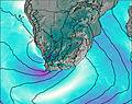
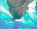
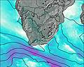
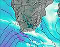
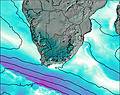
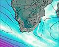
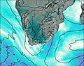
This table gives the weather forecast for Sneeuberg at the specific elevation of 2027 m. Our advanced weather models allow us to provide distinct weather forecasts for several elevations of Sneeuberg. To see the weather forecasts for the other elevations, use the tab navigation above the table. For a wider overview of the weather, consult the Weather Map of South Africa.