
– Lat/Long: 57.93° N 126.85° W
 Thudaka Peak
Weather Forecast, CanadaIssued: 10 am Tue 17 Jun Local TimeUpdates in: hr min sUpdate imminent
Issued: 10 am Tue 17 Jun Local Time
Updates in:
Update imminent hr min s

Issued: 10 am Tue 17 Jun Local Time
Updates in:
Update imminent hr min s
Days 1–3 Weather SummaryA dusting of snow on Wed afternoon. Freezing level rising with drizzle on Thu afternoon. Freeze-thaw conditions (max 2°C on Tue night, min -1°C on Tue morning). Winds increasing (light winds from the ESE on Tue afternoon, fresh winds from the E by Wed night). | Days 4–6 Weather SummaryA dusting of snow on Fri morning. Freezing level rising with drizzle on Fri afternoon. Mild temperatures (max 8°C on Sun afternoon, min 1°C on Fri morning). Winds increasing (light winds from the NNW on Sat afternoon, fresh winds from the NW by Sun night). | |||||||||||||||||
Tuesday 17 | Wednesday 18 | Thursday 19 | Friday 20 | Saturday 21 | Sunday 22 | |||||||||||||
AM | PM | night | AM | PM | night | AM | PM | night | AM | PM | night | AM | PM | night | AM | PM | night | |
clear | cloudy | some clouds | some clouds | light snow | snow shwrs | clear | light snow | rain shwrs | snow shwrs | risk tstorm | snow shwrs | clear | clear | some clouds | rain shwrs | some clouds | some clouds | |
km/h | ||||||||||||||||||
 |  |  |  |  |  | |||||||||||||
— | — | — | — | 1 | 1 | — | 1 | — | 1 | — | 1 | — | — | — | — | — | — | |
— | — | — | — | — | — | — | 1.4 | 0.4 | — | 1.7 | — | — | — | — | 0.1 | — | — | |
max°C | -1 | 1 | 2 | 1 | 2 | 2 | 1 | 2 | 2 | 2 | 2 | 2 | 3 | 6 | 6 | 6 | 8 | 7 |
min°C | -1 | 0 | 0 | 0 | 1 | 0 | 1 | 2 | 0 | 1 | 2 | 1 | 2 | 4 | 5 | 5 | 7 | 4 |
-4 | -3 | -6 | -6 | -4 | -6 | -5 | -2 | -4 | -2 | -1 | -3 | -2 | 2 | 1 | 1 | 4 | 0 | |
2650 | 2850 | 2900 | 2850 | 2850 | 2850 | 2850 | 3000 | 2850 | 2900 | 3000 | 2850 | 3100 | 3450 | 3500 | 3450 | 3700 | 3500 | |
Cloud base (m) | 2800 | 3150 | 3000 | 2750 | 2600 | 2850 | 2700 | 3000 | 3150 | 2700 | 3000 | 8650 | 3850 | 4450 | ||||
4:24 | — | — | 4:24 | — | — | 4:24 | — | — | 4:24 | — | — | 4:24 | — | — | 4:24 | — | — | |
— | — | 10:31 | — | — | 10:32 | — | — | 10:32 | — | — | 10:32 | — | — | 10:32 | — | — | 10:34 | |
Loading...
Thudaka Peak Weather (Days 0-3):
The weather forecast for Thudaka Peak is: A dusting of snow on Wed afternoon. Freezing level rising with drizzle on Thu afternoon. Freeze-thaw conditions (max 2°C on Tue night, min -1°C on Tue morning). Winds increasing (light winds from the ESE on Tue afternoon, fresh winds from the E by Wed night).
Thudaka Peak Weather (Days 3-6):
A dusting of snow on Fri morning. Freezing level rising with drizzle on Fri afternoon. Mild temperatures (max 8°C on Sun afternoon, min 1°C on Fri morning). Winds increasing (light winds from the NNW on Sat afternoon, fresh winds from the NW by Sun night).
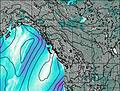
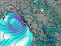
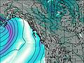
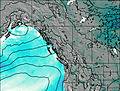
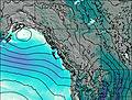
This table gives the weather forecast for Thudaka Peak at the specific elevation of 2748 m. Our advanced weather models allow us to provide distinct weather forecasts for several elevations of Thudaka Peak. To see the weather forecasts for the other elevations, use the tab navigation above the table. For a wider overview of the weather, consult the Weather Map of British-Columbia.
| Weather Station | Temp. | Weather | Wind | Gusts | Cloud / Visibility |
|---|---|---|---|---|---|
Dease Lake Airport | |||||
DeaseLake(Aut)- BC | |||||
Dease Lake A- BC | |||||
FortNelsonUa- BC | |||||
Watson Lake Airport | |||||
Fort Nelson Airport | |||||
Fort Liard- Nwt |
* NOTE: not all weather observatories update at the same frequency which is the reason why some locations may show data from stations that are further away than known closer ones.