– Lat/Long: 46.10° N 7.85° E
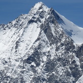
 Dom
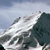
Dom
Weather Forecast, SwitzerlandIssued: 7 pm Tue 17 Jun Local TimeUpdates in: hr min sUpdate imminent
Issued: 7 pm Tue 17 Jun Local Time
Updates in:
Update imminent hr min s

Issued: 7 pm Tue 17 Jun Local Time
Updates in:
Update imminent hr min s
Days 1–4 Weather SummaryA dusting of new snow. Temperatures will be below freezing (max -1°C on Wed afternoon, min -3°C on Tue night). Wind will be generally light. | Days 5–7 Weather SummaryA moderate fall of snow, heaviest on Sat night. Temperatures will be below freezing (max -1°C on Sun afternoon, min -4°C on Sat night). Wind will be generally light. | ||||||||||||||||||
Wednesday 18 | Thursday 19 | Friday 20 | Saturday 21 | Sunday 22 | Monday 23 | ||||||||||||||
night | AM | PM | night | AM | PM | night | AM | PM | night | AM | PM | night | AM | PM | night | AM | PM | night | |
clear | clear | some clouds | clear | clear | snow shwrs | snow shwrs | clear | snow shwrs | snow shwrs | clear | snow shwrs | snow shwrs | clear | clear | clear | clear | some clouds | snow shwrs | |
km/h | |||||||||||||||||||
 |  |  |  |  |  |  | |||||||||||||
— | — | — | — | — | 1 | 1 | — | 2 | 3 | — | 3 | 6 | — | — | — | — | — | 2 | |
— | — | — | — | — | — | — | — | — | — | — | — | — | — | — | — | — | — | — | |
max°C | -3 | -2 | -1 | -1 | -2 | -1 | -2 | -2 | -1 | -2 | -3 | -3 | -4 | -3 | -1 | -2 | -2 | -1 | -1 |
min°C | -3 | -2 | -1 | -2 | -2 | -1 | -2 | -3 | -2 | -3 | -3 | -3 | -4 | -4 | -2 | -3 | -3 | -2 | -3 |
-8 | -7 | -4 | -5 | -5 | -4 | -6 | -7 | -7 | -6 | -8 | -9 | -8 | -10 | -7 | -6 | -6 | -6 | -9 | |
4150 | 4300 | 4400 | 4300 | 4250 | 4450 | 4200 | 4200 | 4400 | 4200 | 4050 | 4150 | 3950 | 4100 | 4400 | 4150 | 4200 | 4400 | 4150 | |
Cloud base (m) | 4350 | 4250 | 9350 | 4350 | 9000 | ||||||||||||||
— | 5:35 | — | — | 5:35 | — | — | 5:37 | — | — | 5:37 | — | — | 5:37 | — | — | 5:37 | — | — | |
— | — | — | 9:22 | — | — | 9:22 | — | — | 9:22 | — | — | 9:22 | — | — | 9:22 | — | — | 9:22 | |
Loading...
Dom Weather (Days 0-3):
The weather forecast for Dom is: A dusting of new snow. Temperatures will be below freezing (max -1°C on Wed afternoon, min -3°C on Tue night). Wind will be generally light.
Dom Weather (Days 3-6):
A moderate fall of snow, heaviest on Sat night. Temperatures will be below freezing (max -1°C on Sun afternoon, min -4°C on Sat night). Wind will be generally light.
This table gives the weather forecast for Dom at the specific elevation of 4545 m. Our advanced weather models allow us to provide distinct weather forecasts for several elevations of Dom. To see the weather forecasts for the other elevations, use the tab navigation above the table. For a wider overview of the weather, consult the Weather Map of Switzerland.