– Lat/Long: 45.92° N 7.88° E
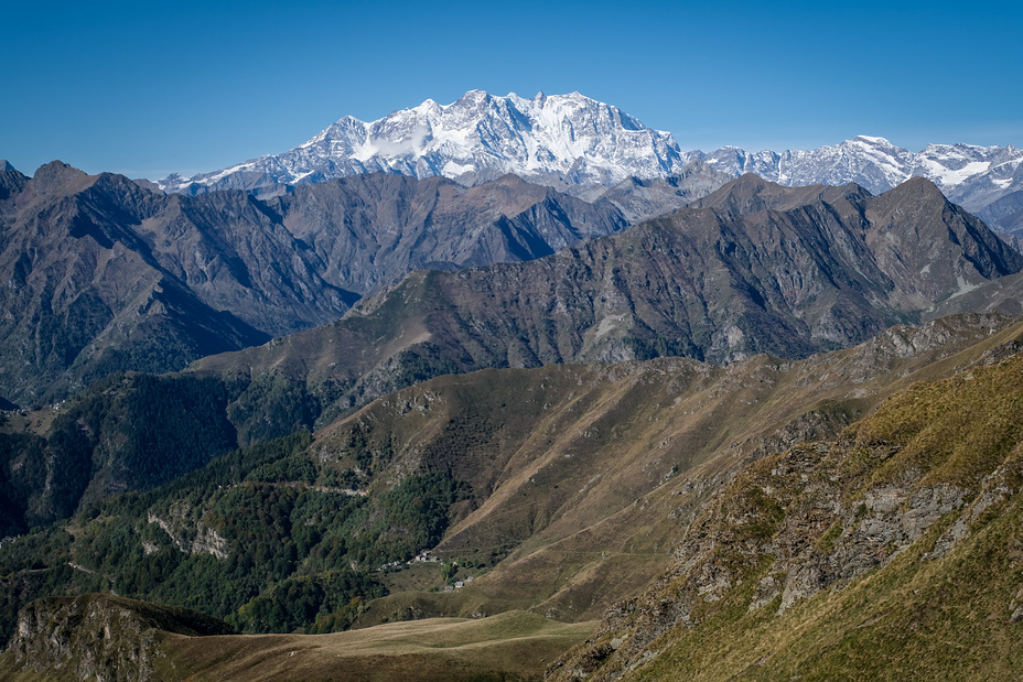
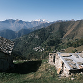
 Dufourspitze
Weather Forecast, SwitzerlandIssued: 7 pm Tue 17 Jun Local TimeUpdates in: hr min sUpdate imminent
Issued: 7 pm Tue 17 Jun Local Time
Updates in:
Update imminent hr min s

Issued: 7 pm Tue 17 Jun Local Time
Updates in:
Update imminent hr min s
Days 1–4 Weather SummaryA moderate fall of snow, heaviest on Thu afternoon. Temperatures will be below freezing (max -2°C on Wed afternoon, min -4°C on Tue night). Wind will be generally light. | Days 5–7 Weather SummaryA heavy fall of snow, heaviest during Sat night. Temperatures will be below freezing (max -2°C on Fri night, min -5°C on Sat night). Wind will be generally light. | ||||||||||||||||||
Wednesday 18 | Thursday 19 | Friday 20 | Saturday 21 | Sunday 22 | Monday 23 | ||||||||||||||
night | AM | PM | night | AM | PM | night | AM | PM | night | AM | PM | night | AM | PM | night | AM | PM | night | |
clear | clear | snow shwrs | snow shwrs | clear | snow shwrs | snow shwrs | clear | snow shwrs | snow shwrs | clear | snow shwrs | snow shwrs | clear | snow shwrs | clear | some clouds | snow shwrs | snow shwrs | |
km/h | |||||||||||||||||||
 |  |  |  |  |  |  | |||||||||||||
— | — | 1 | 1 | — | 3 | 3 | — | 4 | 8 | — | 3 | 7 | — | 1 | — | — | 1 | 3 | |
— | — | — | — | — | — | — | — | — | — | — | — | — | — | — | — | — | — | — | |
max°C | -3 | -3 | -2 | -2 | -3 | -2 | -2 | -3 | -2 | -2 | -4 | -4 | -5 | -4 | -2 | -2 | -3 | -2 | -2 |
min°C | -4 | -3 | -2 | -3 | -3 | -2 | -3 | -3 | -3 | -4 | -4 | -4 | -5 | -4 | -3 | -3 | -3 | -2 | -3 |
-10 | -8 | -6 | -5 | -6 | -5 | -7 | -8 | -8 | -9 | -9 | -10 | -10 | -10 | -9 | -7 | -6 | -6 | -8 | |
4100 | 4250 | 4350 | 4250 | 4250 | 4400 | 4200 | 4200 | 4350 | 4150 | 4050 | 4100 | 3950 | 4100 | 4350 | 4100 | 4200 | 4350 | 4200 | |
Cloud base (m) | 2950 | 9550 | 5150 | 2400 | 2650 | 2400 | 2450 | 2850 | 2450 | ||||||||||
— | 5:37 | — | — | 5:37 | — | — | 5:37 | — | — | 5:37 | — | — | 5:37 | — | — | 5:37 | — | — | |
— | — | — | 9:21 | — | — | 9:21 | — | — | 9:22 | — | — | 9:22 | — | — | 9:22 | — | — | 9:22 | |
Loading...
Dufourspitze Weather (Days 0-3):
The weather forecast for Dufourspitze is: A moderate fall of snow, heaviest on Thu afternoon. Temperatures will be below freezing (max -2°C on Wed afternoon, min -4°C on Tue night). Wind will be generally light.
Dufourspitze Weather (Days 3-6):
A heavy fall of snow, heaviest during Sat night. Temperatures will be below freezing (max -2°C on Fri night, min -5°C on Sat night). Wind will be generally light.
This table gives the weather forecast for Dufourspitze at the specific elevation of 4634 m. Our advanced weather models allow us to provide distinct weather forecasts for several elevations of Dufourspitze. To see the weather forecasts for the other elevations, use the tab navigation above the table. For a wider overview of the weather, consult the Weather Map of Switzerland.
| Weather Station | Temp. | Weather | Wind | Gusts | Cloud / Visibility |
|---|---|---|---|---|---|
ZFC: Gornergrat N. | |||||
ZFC: Kl. Matterhorn | |||||
ZFC: Riffelberg | |||||
ZFC: Gornergr. North | |||||
Pian Rosa Mountain Top Airport | |||||
ZFC: Schwarzsee | |||||
ZFC: Landing Zermatt | |||||
* NOTE: not all weather observatories update at the same frequency which is the reason why some locations may show data from stations that are further away than known closer ones.
Dufourspitze Photos
View all
Pennine Alps photos (199) |
Alps photos (1464) |
photos from mountains in Switzerland (645) |
all photos
 Upload new photo
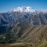
Monte Rosa Massif
Monte Rosa Massif